When you send pre-filled data from the platform to a mobile user in the field (what we also call push), the mobile user can see this data on a map on his mobile device and open Google Maps straight away to start a route for instance.
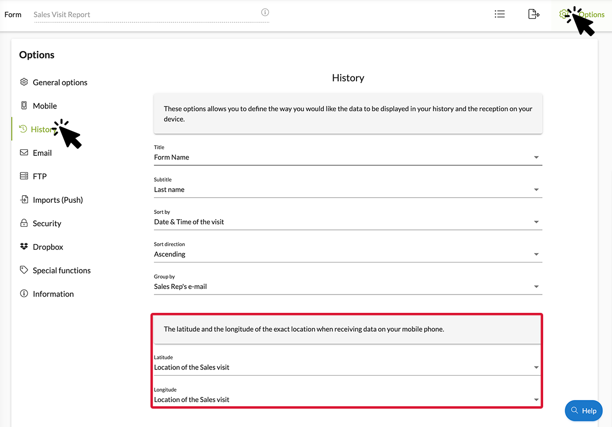
- First, make sure that you put the correct settings. In order to do so, click the options button of your form, then click the History tab and select your element within the Latitude and Longitude scroll bars (see image below).

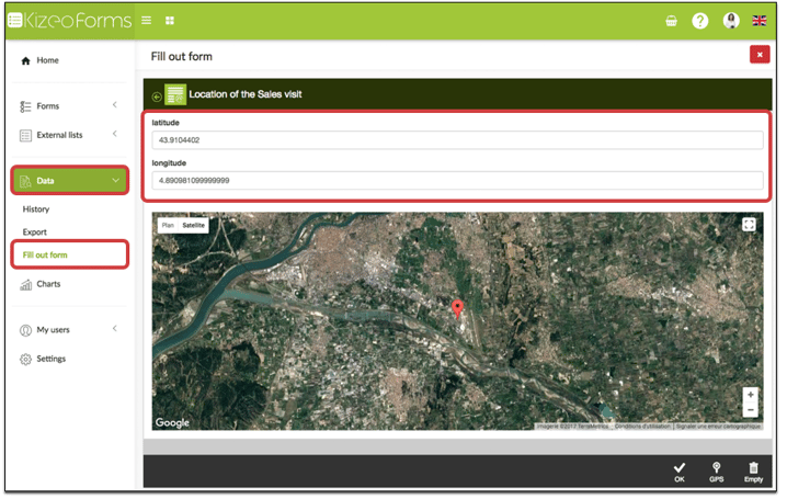
- Go to your platform to send your pre-filled data (push) > Data tab > Fill out form. Don't forget to enter your GPS coordinates so that the pushed data can appear on the map.

- Your mobile user on the field receive the pre-filled data on his mobile device. By opening his App and clicking the My Inbox button, then the Map tab, he will be able to see the pushed data on a map
- By clicking the name of the data (in our example: Sales visit report), a Google Maps icon will appear. Click it and then the Google Maps App will open up. From there, you can start a route if needed.
.jpg?width=225&height=500&name=Screenshot_20230130_151810%20(1).jpg)
To go a little bit further…
- Learn all the possibilities of the Geolocation element!
- How to display pre-filled data on a map from your mobile device.
- Send your pre-filled forms with tables to your field users.
- Organize your team on the field thanks to the user groups.
