Open the GPS navigator directly from the Kizeo Forms application to get to your place of intervention. Learn how to save time with this feature. The calculation tool on the application can generate a link that helps you launch Google Maps from the application.
Step 1 : Configure your site list
Create an intervention list (external list) with references. Ensure the list contains the latitude and longitude of the intervention site.

Step 2 : Set up your form
When creating your form:
- Link the list element to your referential list
- Add your 'reference' fields to display the latitude and longitude
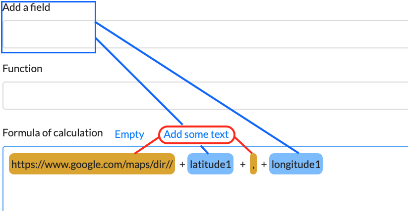
- Insert a calculation element to add the following text:
https://www.google.com/maps/dir// + Your latitude(Reference field)+ , +Your longitude(Reference field)

Thanks to this operation, a clickable link will appear on the application allowing you to directly open the Google Maps from your location to the desired destination (intervention site).
Step 3 : Fill out the form and click on the link to open Google Maps
Fill out the various elements of the form from your mobile device and click on the link displayed on your screen to open the Google Maps with the directions from your location to the intervention site. .gif?width=300&height=667&name=T1%20(4).gif)
